Copious amounts of waste has Soet River in a chokehold
18 September 2024
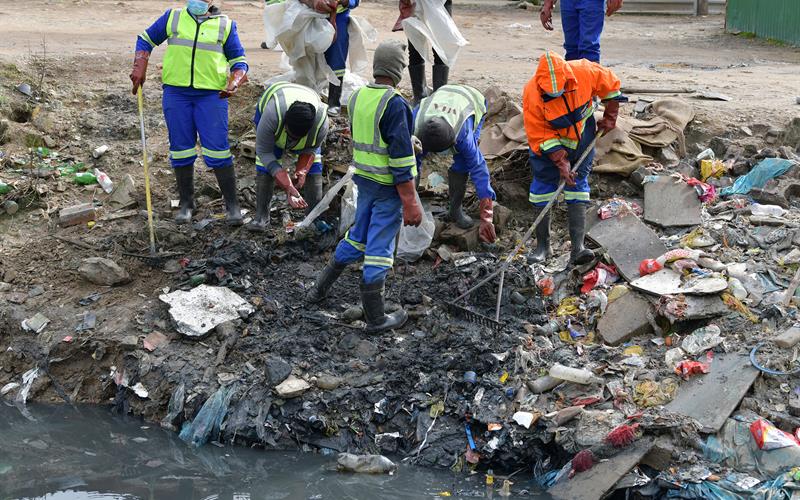
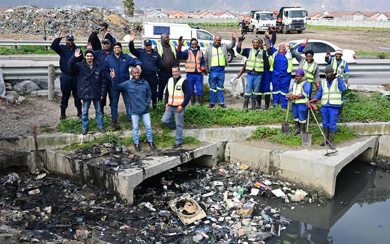
To bolster its existing cleaning interventions, the City of Cape Town has collated the Soet River Pollution Abatement Strategy and Action Plan (PASAP), which outlines multi-pronged efforts to help tackle chronic waste in a section of the Soet River flowing through Lwandle and Nomzamo in Strand. Due to ongoing illegal dumping, this section of the river unfortunately remains filled with solid waste, despite cleaning interventions by the City’s Water and Sanitation and Urban Waste Management Directorates.
Illegal dumping into the section of the Soet River flowing through Lwandle and Nomzamo in Strand remains a challenge for the City who spends at least R1,5 million a year on efforts to clean this waterway.
Since the rapid increase of informality which occurred during the Covid-19 pandemic in 2020, the Soet River has been placed under immense pressure. Besides solid waste, the river has also become the dumping place of night soil (human waste) and grey water.
 The City’s action plan
In response to the challenges, the City put together the Soet River Pollution Abatement Strategy and Action Plan (PASAP) where workable solutions are proposed for implementation in the short, medium and long-term. Some includes:
• Pollution management: This requires developing, implementing and
maintaining integrated pollution management systems like PASAP to effectively
prevent, reduce and control pollution in general.
• Sewer pump stations: Upgrading pump station infrastructure to avoid failures.
• Addressing sewerage overflows from manholes: Regular inspections and
cleaning required, installing litter traps and investigating illegal storm water and sewer
cross-connections.
• River wardens: Train and appoint river wardens to clean the river, report overflows
and related problems that would otherwise remain undetected.
• Improving conditions in temporary informal settlements: Upgrading certain
facilities to reduce the impact of greywater in the Soet River System, as well as upgrades
to reduce flooding, improve public spaces and formalised ablution facilities.
• Bioremediation: Making use of bioremediation technology for the removal of contaminants,
pollutants and toxins from the water flowing in the river.
• Integrated solid waste management: Door-to-door waste collection services, area cleaning
and regular education and awareness campaigns.
 Existing cleaning efforts
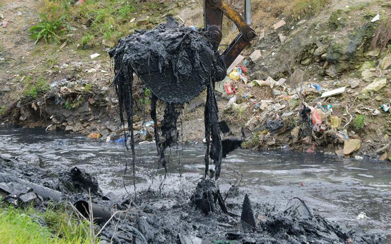
During the 2023/2024 financial year, the City’s Catchment Stormwater and River Management (CSRM) Branch undertook a number of maitenance activities such as cleaning the section next to ACJ Phakade School in Nomzamo, Wag ‘n Bietjie Canal in Lwandle, Broadlands Road Canal in Lwandle, Selven Street (Nomzamo Section), along Onverwacht Road from N2 (Lwandle), Lwandle Canal and Pond, dredging of the Soet River along Onverwacht Road in Lwandle and Nomzamo.
For this 2024/2025 financial year, the CSRM branch intends on spending over R3 Million for maintenance and cleaning (including dregding) several sections of the Soet River and Soet River Canals.
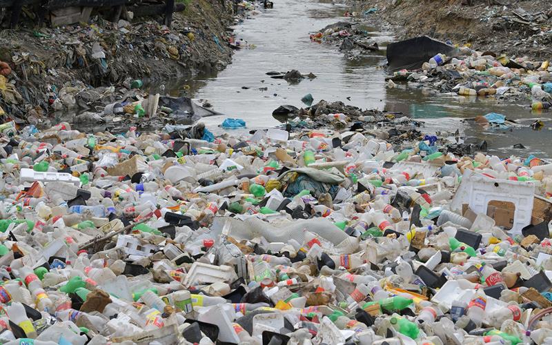
‘Chronic waste pollution due to rapid informality is choking the Soet River, which is not good for residents and the environment, so the City has put together an action plan which will be implemented over time, to help tackle this challenge. This aims to augment City inventions that are already taking place.
Currently the City spends between R1,5 million to R2,6 million each year on continuous cleaning efforts, but while it visually improves for a short while, this is not sustainable because the illegal dumping continues; which also doesn’t improve the water quality in the river.
As we work towards putting this multi-pronged plan into action, we need residents to please join hands with us and put their waste in the right place, using the solid waste services provided,’ said the City’s Mayoral Committee Member for Water and Sanitation, Councillor Zahid Badroodien.
 More about the Soet River
The Soet River catchment has a total catchment area of 17,4 km², which flows from the north-east in a south-westerly direction, and forms the central “spine” of the Soet River catchment’s drainage network. The catchment topography is generally flat, with only the upper contributing sub-catchments to the north of Sir Lowry’s Pass road, being moderately sloped to steep. The catchment has a variety of land-uses. The upper sub-catchments to the north of Sir Lowry’s Pass Road are generally agricultural, while below the Sir Lowry’s Pass Road, the land-use is predominately medium to high density residential, with pockets of industrial and commercial development.
Published by:
City of Cape Town, Media Office